Join Jerry from 6:00 AM to 1:00 PM every Monday-Friday morning. Join Crystal from 1:00 pm to 6:00 pm every Monday-Friday afternoon!
Welcome to CHASINTHEBUCK.COM

Forgot Password

Not a Member? Sign up here!

banner
banner
banner
banner
banner
banner

Weather Archives for 2020-08

Thursday August 27, 2020

Another late blog going up on this Thursday.


If you hadn't heard, Hurricane Laura made landfall early this morning in SouthWestern Louisiana around 1:00 AM Central time. Sustained winds of around 150 mph remained during landfall, making Hurricane Laura remain a CAT 4 hurricane.


With that being said, a lot of damage was left behind, including a damaged radar from one of the National Weather Service sites. This system continues to move Northeast, having a path straight for Kentucky & our local area. 


The system is expected to enter Western KY sometime Friday afternoon & by Friday night into early Saturday morning it will arrive locally here in South-Central Kentucky.


The NWS out of Louisville has a HWO issued for our area, please see below:


Friday through Wednesday.....

Showers and storms are expected Friday into Saturday as the remnants of Hurricane Laura move through the region. 1 to 3" of rainfall with locally higher amounts will be possible through Saturday, leading to the potential for localized flooding issues. Additionally, some of the stronger storms embedded within the rain bands of Laura may be capable of severe wind gusts and isolated, brief, spin up tornadoes. The main severe threat will occur Friday evening and into the overnight hours.


Spotter Information Statement....

Spotters are encouraged to pass along any flooding and severe weather reports Friday and Saturday.


Below are some images to basically sum up everything that was talked about over a webinar/conference call held earlier this afternoon with NWS Louisville:


If there are any dramatic changes, I will definitely be posting another blog to reflect those changes. That does include having any type of Watch or Warning issued as well.


Information I used in tonights blog comes from NWS Louisville's website.


Have a great night!


-Crystal

Hurricane Laura Update - 11:00 PM Aug. 26, 2020

Good Wednesday evening, I know this is a later than usual blog, but I wanted to update everyone on Hurricane Laura before landfall is made. As of 11:00 tonight, Hurricane Laura is a CAT 4 Hurricane and possibly headed to be a CAT 5.


To put this storm in perspective, here are words from the National Weather Service:

"Unsurvivable Storm Surge that could penetrate 40 miles inland, large destructive waves, max sustained winds currently (as of around 10:30 PM) at 150 MPH, and flooding that will potentially impact all the way to Ohio."


It looks like, as of right now, Western Kentucky is under a Moderate Risk (red) of experiencing Flash Flooding through Friday morning, and then here is South Central Kentucky extending up North, we are in the Slight Risk (yellow) of experiencing Flash Flooding. NWS Louisville forecasts that we could see a total of around 2-3" of rain this weekend, that is subject to change as well.


I will be posting another blog later tomorrow afternoon (Thursday) to give an update as Hurricane Laura will make landfall overnight down in parts of Louisiana & parts of Texas.


I hope you continue to follow these updates as this system continues to move inland.


Also keep everyone in these areas in your prayers as they have had to pack up and move away from their homes, knowing it will not be the same when they return. Also prayers for travel & safety for everyone as well.


-Crystal


Email: crystal@shorelinestations.com

thebuck@chasingthebuck.com (ATTN Crystal in the subject line).


Wednesday August 26, 2020 - Hurricane Laura Update

Good Wednesday afternoon. In today's blog, I will be discussing more of Hurricane Laura down in the Gulf & the effects that will have on our weekend weather here in Kentucky.


So as of this afternoon, Hurricane Laura has been deemed a Category 4 Hurricane. This means this is a very dangerous and strong storm, as it moves inland to make landfall. As of 2:00 PM today from the NOAA National Hurricane Center, they state the following: 

"Catastrophic storm surge, extreme winds, and flash flooding are all expected along the NorthWest Gulf Coast tonight." They also state "Little time remains to protect life & property." Water levels have began to rise along the coast of Louisiana. Winds of Hurricane Laura are expected to increase to 140+ mph, even possibly reaching around 190 mph in Port Arthur, TX & Lake Charles, LA. 


Now you may ask, why am I talking about a hurricane that is hundreds of miles from us here in Kentucky? Well, it is pretty simple, the path of Hurricane Laura, after she makes landfall shows that the remnants will sweep all the way here in Kentucky & The Ohio Valley. See image I have attached below as it comes from the NOAA NHC website & includes key messages as well as the images of the path of Laura & the rainfall amounts:


[Key Messages]


The last few days of sunshine and warm temperatures have been amazing & I hope you have taken advantage of that because rain chances increase for us tomorrow into Saturday Night. 


Tomorrow we are currently showing around a 50% chance of showers & storms with highs topping around the mid to upper 80s. Friday, rain & storm chances increase slightly to around 60% with highs in the mid to upper 80s as well. Rain chances will continue overnight into Saturday. By Saturday afternoon, rain/storm chances will be at 90% with high temps decreasing a bit to the low 80s. By Sunday rain chances will decrease dramatically down to 20% and high temps will continue to remain cooler as they hang around 80.


Locally here in South Central Kentucky, we could possibly see 2-3" of rain over the next few days.


All weather information provided above is current as of 3:40 PM EDT this afternoon. If there are any major changes with the forecast I will be sure to post a new blog.


If you have any questions be sure to let me know! I am hoping to get some weather folklore in the next blog.


-Crystal


Email: crystal@shorelinestations.com

thebuck@chasingthebuck.com (Put in ATTN Crystal in the subject line)

Monday August 24, 2020

Monday August 24, 2020

3:43 PM EDT


Good Monday afternoon ya'll! I hope you are having a great day! It is a beautiful start to the week, sunshine & high temperatures in the mid to upper 80s. Be sure to enjoy it because by Thursday/Friday, it could be a different story.


Today I want to talk about a couple of things, one of which is our end of the week forecast because if you haven't seen already, there have been 2 Tropical Storms, Marco & Laura, that are affecting parts of the Gulf. Marco has lost quite a bit of strength as that storm heads towards the Louisiana coastline this afternoon. Laura on the other hand, looks to be a Category 2 Hurricane by the time landfall is made Wednesday night into early Thursday morning. Now with that being said, the path of Laura shows that the remnants are likely to affect our end of the week forecast here in Kentucky, bringing some rain. Currently, the forecast shows around a 60% chance of showers & storms for Friday into Saturday, I will be sure to keep watching & updating if there are any major changes.


Another thing I would like to talk about are cold air funnels. Sunday afternoon, from Horse Cave to Campbellsville, there were multiple reports of funnels spotted and photographed. With the weather conditions at hand, these funnels were not your "regular" funnels. Instead these were what we like to call "cold air" funnels. Even though it can look threatening, a cold air funnel is a weak circulation that occurs in a cool air mass. It develops well above the earth's surface therefore these types are weak and rarely impact the earth's surface. 


Information from the NWS:

"It is usually not necessary for the National Weather Service to issue Tornado Warnings for cold air funnels since it is so rare for them to make it all the way to the ground and become a tornado.  They are also difficult to detect on radar since they are very weak.  Spotter and public reports are essential when cold air funnels are in the area.  The NWS will usually issue a Special Weather Statement when cold air funnels have been reported.  Of course, a Tornado Warning will still be issued if it is felt that a funnel will touch down."


Below, are a few examples of cold air funnels that were photographed here in Kentucky. 

The first photo was near Smiths Grove back on Oct. 25, 2008 (Jason Berry/WBKO).

The second photo was in Hillview, KY on April 17, 2003 (Mark Simpson).

The last photo was in Lexington, KY on May 5 2007 (Alan Creech via Chris Bailey at WKYT).

**All 3 photos are from the NWS website***


I hope you enjoyed this blog a little more than my previous ones. If you have questions of a certain type of weather/weather phenomenon that you want to know more about, feel free to email me and let me know! Sometime soon, I am thinking of doing a blog about some weather folklore, so if you have any old weather tales/folklore you want to share, I would love to see those!


Send me your comments/questions to: crystal@shorelinestations.com!


Thanks for taking time out to read my blog! Have a great day!


-Crystal

Wednesday August 19, 2020

Well it has been a few days since my last blog, so I figured why not share one today.


Today has had more Fall-like weather, which I'm not complaining about. It has given us a break from the higher temperatures, but that won't last long.


We don't have any Special Weather Statements (SWS) or Hazardous Weather Outlooks (HWO) issued for our local area, which is a good thing.


We can expect to see more rain chances back in the forecast from tomorrow into next week, let's take a look at the forecast as it shows as of 3:05 PM this afternoon:


Tonight - Partly Sunny; Lows around 60


Thursday - 20% Showers; Partly Sunny; Highs in the low to mid 80s;

Thursday Night - 20% Showers; Mostly Cloudy; Lows in the mid 60s;


Friday - 80% Showers/Storms; Highs around 82; Best chance of showers/storms will be around mid morning to late afternoon;

Friday Night - 80% Showers/Storms; Lows around the low to mid 60s; Best chance of showers/storms will be in the evening hours;


Saturday - 60% Showers/storms; Partly Sunny; Highs in the low 80s;

Saturday Night - 60% Showers/storms; Mostly Cloudy; Lows in the low to mid 60s;


Sunday - 20% Showers; Mostly Sunny; Highs in the mid 80s;

Sunday Night - Partly Cloudy; Lows in the mid 60s;


I'm still working on getting some more informational weather facts for ya'll so just be patient with me and I hope to have those included in my next couple of blogs.


As long as it isn't an active week/weekend in the weather world, then blogs will sparse.


Thank you again to all of those who have followed, shared, & listen in on 98.7.


-Crystal

Weekend Weather - 8/14/2020

It is Finally Friday! I hope you have had a wonderful week! I know around majority of the local area (South-Central KY), it has been an overcast day with cooler temperatures along with some scattered showers. That chance of scattered showers & storms will continue into your weekend, so if you have any outdoor plans, you may want to stay updated with the latest weather forecast.


We do have a Flash Flood Watch that remains in effect until 10 PM EDT tonight, due to the possibility of localized rainfall amount of around 2-3" being expected therefore causing flash flooding. A Flash Flood Watch means that conditions may develop that lead to flash flooding. Be sure to monitor local media for your latest forecasts and weather updates.


Let's take a look at that weekend forecast into next week:


Tonight - 40% showers/storms; Some storms could produce heavy rainfall; Lows around the upper 60s.


Saturday - 40% showers/storms; AM Fog; Cloudy gradually becoming mostly sunny; Highs around the low 80s; 

Saturday Night - 40% showers/storms; Lows around the mid 60s; 


Sunday - 40% showers/storms; Mostly Sunny; Highs around the mid 80s;

Sunday Night - 30% showers/storms; Partly Cloudy; Lows around the low 60s;


Monday - Sunny; Highs around the low to mid 80s;

Monday Night - Mostly Clear; Lows around the low 60s;


Tuesday - 20% showers; Sunny; Highs around the low to mid 80s;

Tuesday Night - 20% showers; Partly Cloudy; Lows around the low 60s;


**Forecast is as of 3:50 PM EDT this afternoon (Friday Aug. 14, 2020)

**Forecast is always subject to change.


There has been an update within our Saturday forecast as the shower/storm chance had been around 70-80% chance and it is not around 40%.


I hope everyone has a wonderful weekend, if there are any MAJOR changes in the forecast I will do my best to post an updated blog.


-Crystal

Email me at crystal@shorelinestations.com

Tuesday August 11, 2020

Good Tuesday afternoon ya'll! I apologize for not having a blog up yesterday as promised, but I have you covered now!


Another short & sweet blog for you today, just going to take a look at the extended forecast into the weekend because it looks like rain/storm chances are back and are increasing for a couple of days, so if you have plans be sure to stay weather aware.


Basically from the HWO (Hazardous Weather Outlook), as of today, for today into tonight parts of our area could possibly see some isolated showers/storms later this afternoon. Main threats with these storms would be torrential rainfall, gusty winds & C to G (Cloud to Ground) lightning.


For tomorrow into the weekend it looks like the chance for scattered to numerous storms for the afternoon and evening, can be expected due to continued heat & humidity. Main threats with these storms will be gusty winds & heavy rainfall.


Looks like those warm temps will continue into the weekend, lets take a look at that forecast!


Today -  Rest of the afternoon: Partly Sunny; Highs around 85; Can't rule out a pop up shower.

Tonight - Mostly Cloudy with a chance of a shower in the evening; Lows around 70.


Wednesday - 30% Showers/storms late afternoon; Partly Sunny; Highs around the upper 80s to 90.

Wednesday Night - 30% Showers/storms; Mostly Cloudy; Lows around the upper 60s.


Thursday -  50% Showers/storms; Partly Sunny; Highs around the upper 80s to 90.

Thursday Night -30% Showers/storms before early morning; Lows around the upper 60s.


Friday - 60% Showers/storms; Partly Sunny; Highs in the upper 80s.

Friday Night -60% Showers/storms between evening & early morning hours; Partly Cloudy; Lows in the upper 60s.


Saturday - 60% Showers/storms; Mostly Sunny; Highs in the upper 80s.

Saturday Night - 60% Showers/storms between evening & early morning hours; Partly Cloudy; Lows in the upper 60s.


Sunday - 50% Showers/storms; Mostly Sunny; Highs in the mid to upper 80s.

Sunday Night - 30% Showers/storms; Partly Cloudy; Lows in the mid 60s.


I will be back Friday with a little more detailed blog & also with an updated forecast for your weekend, as rain/storm chances continue to change.


Thank you all for continuing to follow these blogs!


-Crystal

Email: crystal@shorelinestations.com


Thursday August 6, 2020

Thanks for joining me for another blog on this beautiful Thursday afternoon, this will be short & sweet as we look at your forecast for the weekend and into next week. If you  have any weekend plans, it looks like the weather will be in your favor. Let's have a look below:


Today / Tonight - We will continue to see partly to mostly sunny skies for the remainder of the afternoon across the local area. Today's highs will top around 84. Tonight it will be partly cloudy with lows around the lower 60s.


Friday / Friday Night - For your end of the week it looks like another beautiful day once we get over the morning fog. By afternoon we will see mostly sunny skies and highs around the mid 80s. It'll be partly cloudy by Friday night with lows around the low 60s.


Saturday / Saturday Night - To kick off your weekend on Saturday it will be sunny and warmer. Highs will be around the upper 80s. Saturday night it'll be mostly clear with lows around the mid 60s.


Sunday / Sunday Night - Rain chances move back into the forecast on Sunday, only about a 20-30% chance and that is more for the latter part of the afternoon. Highs will be in the upper 80s to low 90s. That slight chance of rain will continue into Sunday night with mostly clear skies and lows in the upper 60s.


Monday / Monday Night - Rain chances continue into the new week with a 30% chance in the afternoon with mostly sunny skies and highs around the low 90s. Monday night we will continue to see that 30% chance of showers. Otherwise it will be partly cloudy with lows around the upper 60s to low 70s.


Tuesday / Tuesday Night - Rain/storm chance increases to 50% with partly sunny skies, highs around the upper 80s to low 90s. For Tuesday night it will be partly cloudy along witha 30% chance of showers and lows around the upper 60s to low 70s.


My next blog will be on Monday since the weather will be calm throughout the weekend. If there are any major changes I will post one over the weekend.


As always, I appreciate you taking time out of your day to stop and read my blogs & I hope you continue to enjoy them!


If you have any questions, comments, or feedback feel free to shoot me an email @ crystal@shorelinestations.com


Have a great weekend!


-Crystal


Tuesday August 4, 2020

It's another beautiful day across The Buck listening area on this Tuesday!


This will be short and sweet blog today since yesterday's was a lengthy one. Let's take a look at the forecast for the remainder of the week into the weekend:


Today / Tonight - For the rest of the afternoon we will continue to see partly cloudy to partly sunny conditions with a 20-30% chance of seeing a scattered shower or storm. Todays high temp will top around 80. For tonight, that small chance of showers will continue into the evening, and overnight we will see partly cloudy skies with lows around 60.


Wednesday / Wednesday Night - Looking into midweek, we should expect partly sunny skies with highs in the low 80s. By night, it will be partly cloudy and lows in the low 60s.


Thursday / Thursday Night - The forecast has changed slightly for Thursday, there is a slight chance, , 20-30%, of seeing a shower otherwise it will be mostly sunny and highs around the mid 80s. Thursday night that slight chance of showers will remain for the evening and overnight it will be mostly clear and lows around the low to mid 60s.


Friday / Friday Night - It's going to be a beautiful end to the week as we will see mostly sunny skies on Friday with highs in the upper 80s. Friday night it will be another mostly clear night with lows in the mid 60s.


Saturday / Saturday Night - A beautiful start to the weekend on Saturday with sunny skies and highs around 90. Saturday night clouds will increase a bit and lows will be around the mid to upper 60s.


Sunday / Sunday Night - As of now, for Sunday, it looks like a slight chance of showers (30%) moves back into the forecast for later in the afternoon, otherwise it will be mostly sunny with highs around 90 yet again. Sunday night we will continue to have that slight chance of showers/storms with partly cloudy skies and lows around the upper 60s to low 70s.


So all and all, not a bad forecast this week into the weekend. As always the forecast is subject to change and when it does I will be sure to do my best to update!


I will be back on Thursday with a new blog.


Feel free to email me with any suggestions @ crystal@shorelinestations.com


Have a great Tuesday!


-Crystal

Monday August 3, 2020 Blog

Good Monday afternoon! I hope everyone had a wonderful weekend, & I just want to say thanks for all of you who have read and followed my blogs over the last week. The feedback has been great! If you have any feedback, see at the end for my email you can contact me at.


So far in my previous blogs, I have been able to share with you on how to better understand how the chance of precipitation is calculated. I have also been able to share a couple of definitions as well. Today I want to share something pretty basic, and that is differentiating between a WATCH and a WARNING.


Now there are multiple watches/warnings that can be issued from the NWS (National Weather Service), including: Severe Thunderstorm, Tornado, Flash Flood, Winter Storm, High Wind, Excessive Heat, and so on (you get the point). 


To simply explain the difference between a watch and a warning, it's like this:


WATCH - Be prepared!

WARNING - Take Action!


For example: You have just made it home to your family from work, you hear your NOAA Weather Radio/Local media alert, and it states there is a Severe Thunderstorm Watch effective for your area. So you know you need to be prepared as the chance for a Severe Thunderstorm Warning could be likely. So you now know you definitely need to stay alert and monitor your local media/NOAA Weather Radio for additional updates. So you are BEING PREPARED!


Time goes by, and you notice its getting darker outside, winds are picking up, you can hear thunder and then all of a sudden your weather radio/local media alerts you that a Severe Thunderstorm Warning is now in effect for your area. Hopefully you already have a plan in place on what you and your family needs to do during severe weather. If you have a plan in place then you act on it, whether its finding a more substantial structure to move to (especially if you live in a mobile home), taking shelter in a more sturdier part of your home, etc. By doing so you are TAKING ACTION!


Hopefully that helps in the understanding the difference between a Watch and a Warning. Be on the lookout for my future blogs this week to share what types of alerts can be issued by the NWS, and also how they go from a watch to a warning (what indicates the severeness?).


Now lets take a look at our forecast for the first full week of August! It looks to be a better looking forecast compared to last weeks; (Forecast is as of 11:00 AM today (8/3/2020) 


Today / Tonight - We will see plenty of sunshine today but we can't rule out a stray shower as there is only a 10% chance of rain. Looks like we will average in the mid to upper 80s for highs. Tonight we have a 20% chance of rain with partly cloudy skies. Tonights lows around the low 60s.


Tuesday / Tuesday Night - We will kick off Tuesday by seeing some areas of patchy morning fog. As the day goes on, rain chances increase to 40% with partly sunny skies. Highs will be around the upper 70s to low 80s. Tuesday  night looks to be about the same, 30% showers, partly cloudy with lows around 60.


Wednesday / Wednesday Night - Wednesday will be the first day of this week that there is no chance of rain. We will see partly sunny skies with highs around the low to mid 80s. Wednesday night looks to be mostly clear with lows around 60.


Thursday / Thursday Night - Another day without a chance of rain, it will be beautiful as mostly sunny skies are forecasted with highs in the mid 80s. Thursday night will be clear with lows around the lower 60s.


Friday / Friday Night - To end the week on Friday, it looks like it will continue to be beautiful & warmer, as we should see sunny skies and highs around the upper 80s. Friday night an increase in clouds will make for partly cloudy skies and lows will be around the mid 60s.


Weekend weather as of today, looks to be warming up as temps on Saturday & Sunday will average in the upper 80s, possibly hitting 90. We will have the chance of showers re-enter the forecast for the weekend, currently around 20% on Saturday & 40% for Sunday. Other than that it looks to be mostly sunny.


Disclaimer: The forecast is subject to change, when it does I will be sure to update as soon as I can.


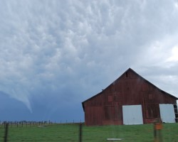
That's it for today's blog! Don't forget to email me and let me know what you would like to see in my blogs! Hopefully soon, I will be able to incorporate some local weather photos.


Thanks again & I hope you have a wonderful Monday!


Email: crystal@shorelinestations.com


-Crystal


On Air Now

WKDO Air Staff
WKDO Air Staff
6:00pm - 12:00am
Regular Programming

CNN News

Entertainment News

Twitter