Join Jerry from 6:00 AM to 1:00 PM every Monday-Friday morning. Join Crystal from 1:00 pm to 6:00 pm every Monday-Friday afternoon!
Welcome to CHASINTHEBUCK.COM

Forgot Password

Not a Member? Sign up here!

banner
banner
banner
banner
banner
banner

Weather Archives for 2020-09

Thursday September 24, 2020

Good Thursday afternoon, I have you find yourself doing well today! I want to start off by saying Thank you to everyone who comes across these blogs of mine and for sharing them out. I know they may be simple in regards to weather information but I enjoy being able to get these shared out!


So since my last post, it does seem that our forecast for the weekend has changed, so I will go over that below & be sure to read to the bottom because I am looking for some local photos to use! B


Let's take a look at that updated forecast!


Tonight - Clouds will continue to hang around tonight as we will see mostly cloudy skies & around a 40% chance of rain. Lows will be in the upper 50s.


Friday - Finally Friday looks to have a 30% chance of rain, which we should see in the early to mid morning hours. Otherwise, we will continue to see mostly cloudy skies with highs in the low 70s.

Friday Night - No rain chances tonight, but we will see mostly cloudy skies and lows in the upper 50s to around 60.


Saturday - We will see a break from the clouds as it looks to be partly-mostly sunny with his in the upper 70s, some areas will see 80.

Saturday Night - It will be mostly clear with lows around 60.


Sunday - Another beautiful day for the weekend, as it will be mostly sunny with highs around 81.

Sunday Night - A small rain chance of around 30% (can't rule out seeing a scattered storm) will return to the forecast along with mostly cloudy skies. Lows will be around the upper 50s.


Monday - Rain chances will continue, currently showing around a 30% chance of rain with partly sunny skies. Highs around the mid 70s.

Monday Night - It will be partly cloudy with a slight chance of showers, lows in the low 50s.


**Forecast is subject to change, the above forecast is as of 9/24/2020 at 3:00 PM**


Now as I mentioned before the forecast, I am looking for local photos! Whether you are located in Casey, Lincoln, Boyle, Adair, Taylor, Green, Russell, Pulaski, or any part of South Central/Southern Kentucky, I want you to send me your photos!


So what I am looking for are themed photos. Each week I will share a new theme of photo I am looking for here within my blog. If you have a photo you would like to submit, then email it at crystal@shorelinestations.com.


The purpose of getting local photos is because I would love to use them as our forecast background! We share these forecasts each and every morning on our Facebook page & I feel like it would be more personable to our listeners & followers.


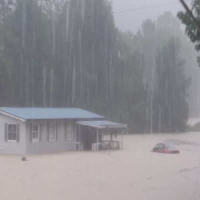
So this weeks theme of photos is a choice. I am looking for either a rainy day photograph, OR a fall day photo. Please keep in mind that I want LOCAL photos, nothing searched for and found on the internet. I prefer 1-2 photo submissions per person.


I will need the following information:

-Photographer Name

-Location of where photo was taken (City/County format or you can give your road name along with the city/county)

-Date photo was taken


I will give credit on our forecast graphics, therefore why the above listed information is very important to be submitted.


I can't wait to see all these awesome photos!


Crystal


Monday September 21, 2020

Good Monday evening! It has been awhile since my last blog & I apologize for that! A lot has happened in the last couple of weeks in my hometown, including another flooding event, you can see a couple of photos below. 


Last Sunday, flooding took over numerous parts of Casey County, including having numerous swift water rescues which was assisted by neighboring rescue teams (thank you to all who helped!). Thanks to all of our law enforcement, dispatchers, county road crews, state road crews, electric crews, fire fighters, & everyone else who helped making sure folks were safe before, during, & after the flooding. So thankful it wasn't worse than what it was.


Photo Credit: Pam West - Liberty, KY


Since then, we have dealt with a cold front that pushed in behind the rain therefore making it feel more like Fall (which I'm personally enjoying). Our high temperatures across the area averaged in the upper 60s to mid 70s, while low temperatures averaged a bit cooler in the mid 40s to low 50s.  It looks like Fall will continue to hang around for the rest of this week as well along with rain chances making their way back, take a look below:


Tuesday - Mostly Sunny; Highs in the low to mid 70s.

Tuesday Night - Mostly Cloudy; Lows in the low 50s.


Wednesday - Mostly Cloudy; Highs in the mid 70s.

Wednesday Night - 20% Showers, Mostly Cloudy; Lows in the mid 50s.


Thursday - 30% Showers (After 1-2 PM), Mostly Cloudy; Highs in the mid 70s.

Thursday Night - 40% Showers/possible storm, Mostly Cloudy; Lows i the mid to upper 50s.


Friday - 30% Showers, Partly Sunny; Highs in the mid 70s.

Friday Night - 30% Showers, Partly Cloudy; Lows warming up to the low 60s.


Saturday - 40% Showers, Partly Sunny; Highs in the upper 70s, around 80 in some places.

Saturday Night - 40% Showers, Mostly Cloudy; Lows in the low 60s.


So nothing to dramatic in regards to the change in weather from now until the weekend. Remember the forecast is always subject to change & when it does, I will pass along the most up to date weather information.


Don't forget I am still adding to my list of WEATHER FOLKLORE tales, so if you have some you want to share to be in my blog, you can email them to me at crystal@shorelinestations.com


Have a great rest of the week!


-Crystal

crystal@shorelinestations.com

Wednesday Sept. 9, 2020

It's been a beautiful week so far across The Buck listening area. Labor Day weekend even had some beautiful weather as well.


I hope everyone has been well since my last blog which was last month! Things have been busy and the weather world has been calm.


Taking a look at the forecast for our local area for the remainder of the week into the beginning of next week, looks to remain calm. We will see the chance for showers & storms this weekend though.


Tonight - Mostly Clear; Lows in the mid 60s.


Thursday - Patchy morning fog to start off with then by afternoon it will be sunny; Highs around the upper 80s.

Thursday Night - Mostly Clear; Lows in the mid to upper 60s.


Friday - Partly Sunny; Highs in the mid 80s.

Friday Night - Partly Cloudy; Lows in the mid to upper 60s.


Saturday - 50% Showers/Storms (Afternoon), otherwise Mostly Sunny; Highs in the mid to upper 80s.

Saturday Night - 50% Showers/Storms (Early AM), otherwise Mostly Cloudy; Lows in the upper 60s to low 70s.


Sunday - 70% Showers/Storms (Morning into Afternoon), otherwise Partly Sunny; Highs in the mid 80s.

Sunday Night - 20% Showers, Partly Cloudy; Lows in the low 60s.


Monday - Mostly Sunny; Highs in the low 80s.


I know in a few of my blogs I have mentioned about weather folklore. You know, those weather sayings that maybe your parents, aunts, uncles, grandparents, or even great-grandparents would tell you to predict their own weather? So in this blog I would LOVE to receive some of your alls weather folklore and share in future blogs. If you have one or two or five you want to submit to me, do so my emailing me at crystal@shorelinestations.com. 


I know in the month of August, I have always heard however many fogs there are, will be how many snows we get in the winter months. I have also heard about seeing a "Sun dog" that it will rain the same time when you see that, the next day. (Ex: If you see one at 4:00 PM on a Sunday, then it's supposed to rain/weather at 4:00 PM on Monday).


I hope to have some awesome weather tales to share in my next blog. So start sending them my way!


-Crystal

Email: crystal@shorelinestations.com


On Air Now

Jerry Atwood
Jerry Atwood
6:00am - 9:00am
Buck Morning Show

CNN News

Entertainment News

Twitter