


Merry Christmas Eve! Just a quick update with some images attached that I have received from NWS this morning including information about a Winter Weather Advisory that will be in effect from 11 AM today through 10 AM tomorrow morning. Check it out below:
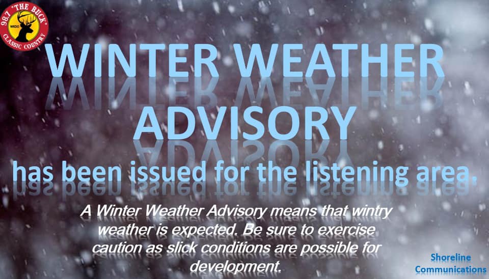
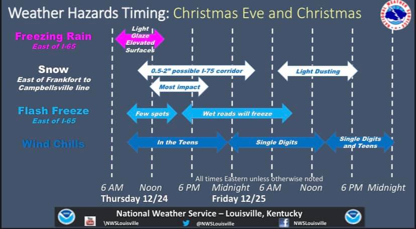
***Winter Weather Advisory***
A Winter Weather Advisory will be in effect for the local area from 11:00 AM today until 9:00 AM tomorrow morning. Expect anywhere from a dusting up to 1" of snow with a light glazing of ice during this time. Travel may become impacted later on tonight. Use caution if traveling.
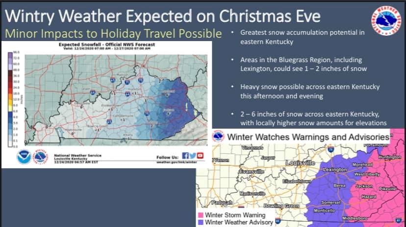
***Information from NWS***
An arctic blast will bring a mix of wintry weather to the region this morning through Christmas Day. The first impact could be a few slick spots this morning in any areas where the wind hasn't been able to dry off roadways. Also, there is a small signal for a band of freezing rain to develop somewhere east of the I-65 corridor later this morning.
There's a better chance for some minor snow accumulations this afternoon and early evening, again mainly east of I-65. By this evening, temperatures will crash into the lower to mid 20s...causing any remaining wet roadways to freeze. A Winter Weather Advisory is in effect from late this morning through Christmas mid morning, both for that snow potential as well as for the potential of black ice.
The other concern will be wind combined with those colder temperatures. Wind chills will drop into the teens this afternoon and then into the single digits late tonight and into most of Christmas Day.
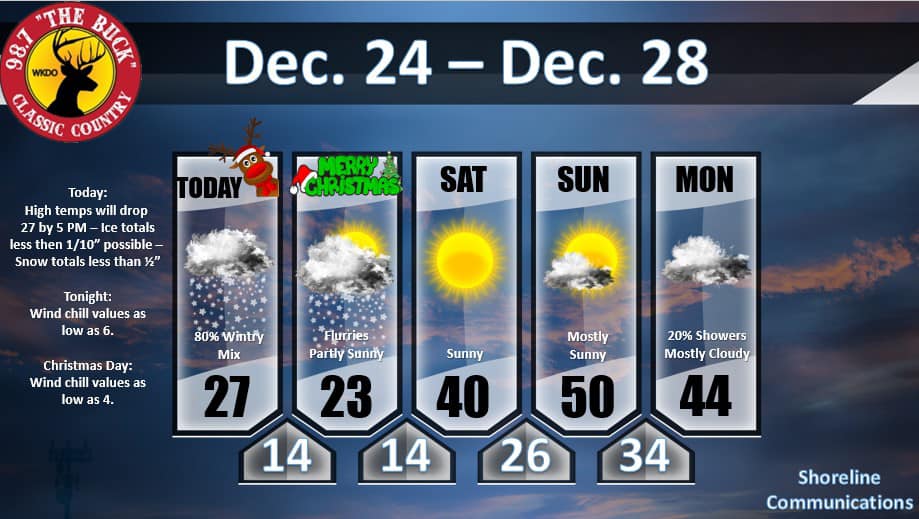
***Forecast Outlook***
Below is your forecast over the Christmas Holiday into the weekend:
If there are any other MAJOR changes, I will be sure to make a new blog & pass that information on. I will also pass it along on-air on 98.7 & also to our Facebook page if you follow us on there at Classic Country 98.7 The Buck!
I hope everyone has a wonderful, safe, blessed, & Merry Christmas!
-Crystal
.jpg)
.jpg)
.jpg)
.jpg)
