


.webp)
98.7 The Buck's Weather Blog is sponsored by the following:
The Labascus Armory - check them out on Facebook, website labascusarmory.com, call 606-706-0189
Hines Mowing & Welding – check them out on Facebook, or call Adam 606-303-1262 or Colton 606-706-2488.
Spring is right around the corner but that isn’t going to keep winter weather away. Let’s talk about what to expect below:
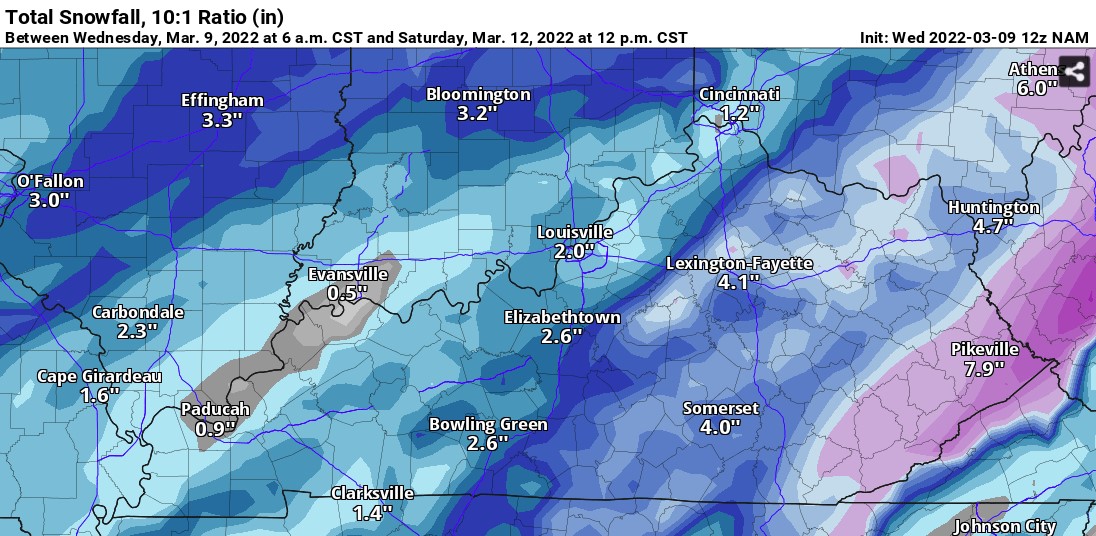
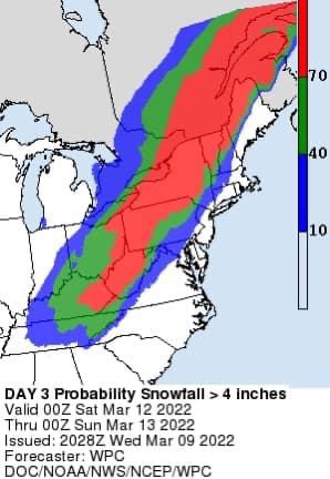
Sunshine & mild temperatures will remain for Thursday & Friday. Then Friday night is when we will expect to see some snow showers. Snow accumulations are up in the air, model images of the GFS & NAM models through Noon Saturday are below. There is also an image of what the WPC (Weather Prediction Center) is predicting with a 40-70% chance of seeing snow totals of 4” or more. Keep in mind, snow totals vary and are not set in stone and will continue to change.
.jpg)
Confidence is increasing that this could be a Winter Storm for some areas.
After we see snow & colder temps, mild temps & sunshine will make their way back into the forecast Sunday, Monday, & Tuesday of next week. See below:
Thursday – Mostly Sunny; Highs in the mid to upper 50s
Thursday Night – Mostly Clear; Lows in the mid-30s.
Friday – 20% Showers; Mostly Sunny; Highs around 61
Friday Night – 80% Rain/Snow; Lows in the low-20s.
Saturday – 20% Flurries; Partly Sunny; Highs around 30.
Saturday Night - Mostly Clear; Lows in the low-teens.
Sunday – Sunny; Highs in the upper-40s
Sunday Night - Mostly Clear; Lows in the low-30s
Monday – Mostly Sunny; Highs in the upper-50s
Monday Night – 40% Rain; Mostly Cloudy; Lows near 40.
Tuesday – Mostly Sunny; Highs near 60.
If there are any major changes with the models I will be sure to update you on 98.7 & here on our blogs.
Crystal
crystal@shorelinestations.com
