


Good evening, folks. Crystal here with another update in regards to our winter storm event that has already started to move into the state.
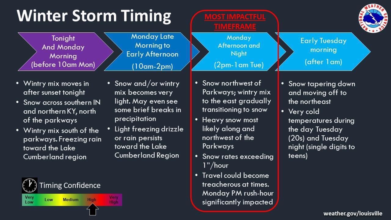
One thing I would like to reiterate is that this storm will have 2 waves. The first wave of this system will have widespread precipitation developing by midnight, some of which has already moved into our local region this evening. While the northern part of the state into southern Indiana will see snow with this first wave, south of the river & northwest of the Bluegrass/Western Parkways will see sleet/snow mix. Southeast of the Parkways will see more freezing rain. The areas seeing snow from this first wave will be an average of 1-3". Ice totals will possible up to 1/4". Precipitation is expected to decine by mid-morning tomorrow, which will allow a small break before this second wave makes it way in.
Moving on to the second wave, this will be a more significant wave and pack a punch so to speak. For our local region here in South Central Kentucky, we should see this arrive by tomorrow afternoon around Noon to 1 PM EST. This wave will continue to push it's way through the rest of the state as your afternoon/evening goes on. There will be more of a colder air with this wave compared to the first wave therefore the transition of snow/sleet/freezing rain will shift more towards the East as the days goes on into the evening and night hours.
I have attached within this blog, are the latest slides issued from NWS as of 5:27 PM EST (please pay attention to the date & time of these blogs and slides so you are not confused).
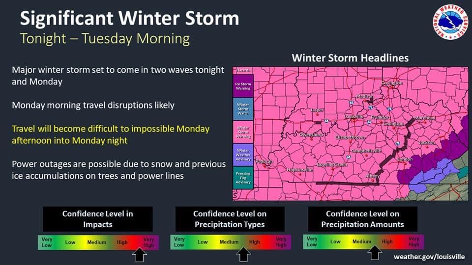
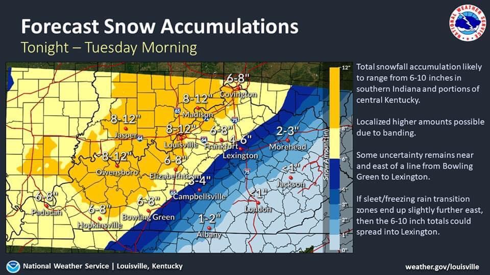
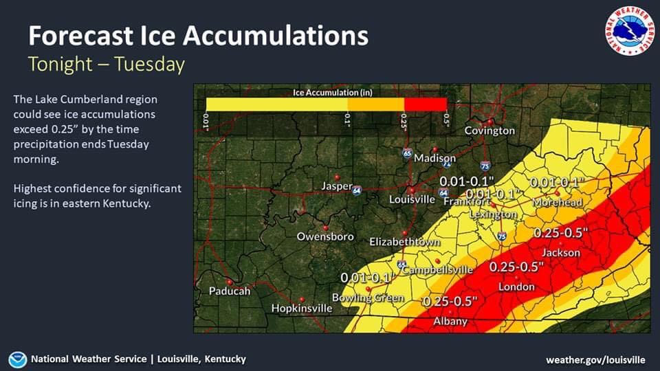
As you can tell with these updated slides, the snow accumulation has decreased a bit for some areas, I am still sticking with my previously mentioned total range of 4-8". Ice accumulations continue to change, areas could see up to 1/4" while others can possible see up to 1/2". If you notice, those areas with the higher snow totals will have a decreased ice total & those areas with a higher ice total have a decreased snow total. It's all about the movement of the warm air & cold air.
I will be sure to update with another blog if there are any other MAJOR changes with this system the closer it moves to our area. Until then I hope everyone has made their necessary preparations especially since power outages are bound to take place with this system.
I will go ahead and say after this system there will be a small break Tuesday night into Wednesday before another system brings in more snow/sleet/freezing rain Thursday (I am monitoring).
Please be sure to check on the elderly, make sure outdoor pets/livestock are taken care of, & it doesn't hurt to have multiple emergency kits made up for home & for each vehicle (including filling up on fuel).
I will update when needed. Thanks for following & sharing!
-Crystal
crystal@shorelinestations.com
