


Good Sunday afternoon, here is an update from the 11:30 AM Conference Call held with the National Weather Service (NWS):
Updated NWS Briefing Slides Attached
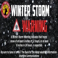
•Winter Storm Warning effective from 7 PM tonight - 1 PM Tuesday. Snow accumulations still ranging from 4-7" with ice accumulations remaining up to 0.25".
•Locally we will have this system move into our area late tonight / early tomorrow morning.
•Most freezing rain will be overnight from Burkesville, Columbia, Jamestown, to Liberty. Total ice ranges showing 0.01 up to possible 0.25 for these areas all the way into the Eastern part of the state. Far east from Jackson to Pikeville shows ice totals ranging from 0.25 – 0.50.
•Uncertainty remains with some totals in exact locations.
•Adjustments to totals & forecasts are possible permitting how this system’s path pans out.
•After this system moves through and we get a break Wednesday, there will be another system that moves through the area Wednesday night into Thursday. Will update once updates are received.
You are more than welcome to send me any questions you may have to crystal@shorelinestations.com
Be Prepared folks!


