.jpg)
Good Sunday evening, I hope you have had and are continuing to have a great weekend. I do have some weather information to pass along to you to keep you on top of what we will be seeing over the next 24 hours for our local area, so let’s get started.
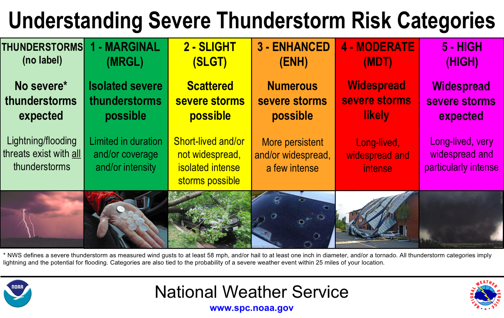
Some parts of the local area have seen some rain today, nothing major though. As your evening and night goes on into tomorrow, rain chances will be at 100% and rain totals will average any where between 1” to 2”. These will be widespread rain showers that we will be seeing, some of which could be heavy at times therefore causing some localized flash flooding. The SPC has already placed parts of our local area back Westward, under a MARGINAL (see graphic below to category definition) risk for thunderstorms as well. Yes, I said thunderstorms, here in January. It’s Kentucky what do you expect?
*******************************************************************************************************
As the warm front pushes through, that means moderate to occasional heavy rain will move northward and into South Central Kentucky later on tonight. Monday will be our all-day rain event, as I stated above, with rain totals averaging from 1-2”. Current models are showing that the heaviest rain showers could drop around 1 inch of rain in 3 hours. In regards to Flash Flood Watches/Warnings being issued, that amount of rain still falls short of the guidance that is needed to have those issued. We cannot rule out having a Flash Flood Watch issued as models update & as this system pushes through tomorrow.

Now when it comes to temperatures for your Monday afternoon, you may be pleasantly surprised as we will have high temperatures around the upper 50s - lower 60s for most of the area. Monday night low temperatures will be around 40 degrees with the continued rain chance, just decreased.
Extended Forecast:
Monday night rain chances decrease and rain will push out of the area. By Tuesday we will see clear & sunny skies with high temperatures in the upper 50s along with a slight breeze (7-10 mph). Our next rain chance will be on Wednesday currently showing a 40% with Partly Sunny skies, highs in the upper 40s-50 degrees. Rain chances will continue into Wednesday night, a slight increase in the chance, low temperatures will have a drop into the mid 20s. By the weekend, we could see a warm up with high temperatures back in the 50 degree range.
I will post another blog tomorrow as time allows and also if there are any flooding issues within our local area.
-Crystal
crystal@shorelinestations.com